WORLD INFO
The World’s Oceans

What are the oceans of the world?
A body of water that is mostly salt water is called an ocean. It covers nearly 70% of the surface of the Earth. Seas comprise of somewhat more than 95% of the world’s all’s water. Although a sea is a part of an ocean, land typically surrounds it in part. Additionally, oceans are much deeper and larger than seas.
The five oceans that make up the surface of our globe are the Pacific Ocean, the Atlantic Ocean, the Indian Ocean, the Southern Ocean, and the Arctic Ocean.
The Pacific Ocean
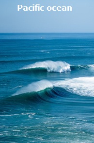
The Pacific Ocean, which accounts up more than 30%, or one-third, of the planet’s surface, is the largest ocean in the world.
Oceans cover almost half of the earth’s surface, and the Pacific Ocean’s size is greater than the sum of the areas of all the continents. It touches North America’s west coast. Challenger Deep is the name of the lowest known place on earth.
It is situated at the end of the Mariana Trench in the Philippine Sea in the Pacific Ocean, close to Guam. At a depth of 36,037 feet, it is deeper than Mount Everest.The trench’s extraordinary depth is caused by its location at the intersection of two tectonic plates. Earthquakes frequently occur near the ocean’s coastline in Japan and North America.
The ocean was given its name by intrepid traveller Ferdinand Magellan. He described a “calm sea” by using the word “pacific.”As a result, Pacific Ocean is an ocean of peace. But, the Pacific is not entirely calm and serene.
The Pacific Ocean is the location of the “ring of fire”. The Ring of Fire, a chain of 450 volcanoes in a U – shape, is located in the Pacific Ocean. They stretch from South America through New Zealand, along the coast of Japan, and the western United States, all the way down to the equator.
Since the Pacific basin is home to a number of still-active volcanoes, it frequently experiences large earthquakes and volcanic eruptions.
The Great Barrier Reef, which sits off the coast of Australia, is the biggest coral reef in the world.
The Atlantic Ocean
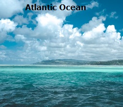
Between the continents of America, Europe, and Africa is the second-largest ocean in the world, the Atlantic.
20% of the Earth’s surface is covered by the Atlantic Ocean, which is about half as large as the Pacific Ocean. Yet, as it moves along the Mid-Atlantic Coasts, it is expanding in size.
Is believed to have developed during the Jurassic Era. Moreover, it has connections to the Atlantic, Pacific, Arctic, and Southern Oceans. The Northern Atlantic and the Southern Atlantic are separated by the equator.
The majority of the geological activity in the Atlantic Ocean, which is regarded as a passive margin ocean, is concentrated in the Mid-Atlantic Ridge. The vast majority of its coastline areas are low and geologically unactive.
The Mediterranean Sea, the North Sea, the Baltic Sea, Hudson Bay, the Gulf of Mexico, and the Caribbean Sea are some of the major marginal seas of the Atlantic. The Atlantic is 82 million square kilometres in size (32 million square miles). It is 3,600 metres deep on average (11,812 feet). Its deepest point is 8,605 metres in the Puerto Rico Trench (28,231 feet).
The seas of the Atlantic are home to sharks, like this Thresher Shark swimming in the Gulf Stream. The ocean is home to a diverse variety of marine life, including organisms that live more than 3,000 feet below the surface and turtles and dolphins. The largest island in the world, Greenland, is oddly situated between the Atlantic and Arctic Oceans.
The Indian Ocean
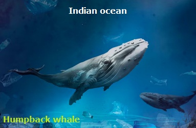
Third large ocean in the globe is the Indian Ocean. It includes a number of tropical islands and occupies around 1/5 of the surface of the planet. Africa forms the ocean’s northwest border, followed by Antarctica, India, and Asia in the north, and Australia in the east. The Arabian and Laccadive Seas are part of it.
The world’s warmest ocean is the Indian Ocean. This implies that a wide range of marine organisms cannot survive in its warmer waters. Surprisingly, some of the most significant ports in the world, such those in Mumbai and Kolkata, can be found on the sea.
The Indian Ocean is the smallest of the three major oceans, with a surface area of 73 million square kilometres (28 million square miles), or about 20 percent of the total ocean surface area. 3,890 metres is the average depth of the Indian Ocean (12,762 feet). The Java trench is its deepest point, measuring 7,725 metres.
The Indian Ocean’s waters serve as the largest humpback whale breeding grounds in the entire planet. A fish that was believed to be extinct was also found in the Indian Ocean. Between Mozambique and Madagascar, in the warm seas off the Comoro islands, the coelacanth can be found.
Because to its connection between Asia and the Middle East’s oil-rich nations, the Northern Indian Ocean is also crucial for the transportation of oil. On its waterways, tankers transport 17 million barrels of crude oil daily from the Persian Gulf.
The Southern Ocean

In the Southern Hemisphere, off Antarctica, the Southern Ocean is situated near the South Pole across from the Antarctic Circle.
The Southern Ocean is currently the fourth-largest ocean in the planet (after the Pacific Ocean, Atlantic Ocean, and Indian Ocean, but larger than the Arctic Ocean). 24,390 feet, or 7,434 metres, is the depth at which the ocean is deepest. Climate change has caused its ecosystem to shift significantly in recent years. Animals like seals, penguins, and orcas live in the waters.
Wandering albatrosses and Emperor Penguins both reside in the Southern Ocean.
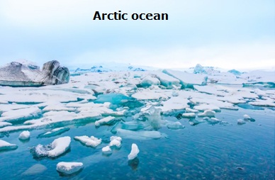
The Arctic Ocean
5.427 million square miles (14,055,865 square kilometers)
Around the North Pole, beyond the Arctic Circle, is where you’ll find the Arctic Ocean.More than five times smaller than the Indian and Atlantic oceans, the Arctic Ocean is the world’s tiniest ocean and is recognized as the coldest of all the oceans with the lowest salinity. Compared to other oceans, sealife is considerably more difficult to observe.
Polar bears can be found in large numbers on the Arctic ice.
A jellyfish known as the ‘Lion’s Mane Jellyfish’ can also be found in the Arctic Ocean. It can grow to be 2.4m (8 ft) broad and feeds on plankton and fish. Through a narrow, shallow waterway known as the Bering Strait, it is connected to the Pacific Ocean.
| Rank | Ocean | Remark |
| 1 | Pacific Ocean | Separates Oceania and Asia from the Americas |
| 2 | Atlantic Ocean | Separates the Eurasia and Africa from Americas |
| 3 | Indian Ocean | Spreaded upon southern Asia and separates Africa and Australia |
| 4 | Southern Ocean | It encircles Antarctica, considered an extension of the Pacific, Atlantic and Indian Oceans |
| 5 | Arctic Ocean | A sea of the Atlantic, which washes upon northern North America & Eurasia and covers much of the Arctic |
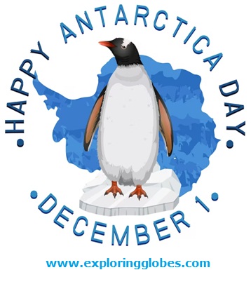
Facts about Antarctica
- By population, Antarctica is the smallest continent. As a result, the vast continent is only sparsely populated.
• On Antarctica, there are only temporary research stations for scientists, and the land is almost entirely covered by ice.
- This continent, which accounts for 60% to 70% of the world’s freshwater supply, is home to 90% of the planet’s ice.
• 75% of the world’s ice and 70% of the planet’s fresh water are found in Antarctica, making it not only the coldest spot on Earth, but also the highest, driest, windiest, and emptiest.
- The White Continent or the Ice Continent are other names for it. Antarctica was referred to as “Terra Australis Incognita” prior to 1840, which was Latin for “the undiscovered southern land.”
• In Antarctica, the winter months of late March to late September are completely dark during the day, while the summer months of December to February provide 24 hours of light.
• The Ice Continent has summertime lows of roughly -35 degrees Celsius in the interior and 2 degrees Celsius in its coasts. In the winter, the interior registers -70 degrees Celsius while the beaches register 2 degrees.
• At -89 degrees Celsius, Antarctica was the lowest natural temperature ever measured on Earth.
• As a result of these significant temperature swings, the creation of ice along Antarctica’s periphery makes the continent’s wintertime area approximately 14.2 million square kilometers bigger than its summertime area.
• There are no time zones on this continent, and nothing can rot in the frigid waters of Antarctica.
- The Belgica Antarctica bug, which has a length of 1.3 cm, is the largest land animal in Antarctica.
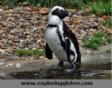
• Penguins call Antarctica home, and Adelie penguins are the most prevalent species here. The only permanent populations in Antarctica are the research bases where experts from many nations come to work.
The Antarctic Circle is shown on the map, and Antarctica is the fifth-largest continent by area after Asia, Africa, North America, and South America. Antarctica has a land area of 14 million km2, of which 280,000 km2 are ice-free and 13.72 million km2 are covered in ice.
The South Pole, which is customarily the southernmost point on Earth’s surface, is not nearly in the centre of Antarctica (wherever you would go from here you would go north, somehow).
One of the ends of the Earth’s rotation axis is the South Pole. Because Earth rotates slightly off-center, the South Pole is not actually a fixed location.
Scientists refer to this phenomenon as the Polar Motion; it is the movement of Earth’s rotational axis over its “surface,” and the deviation is only a few metres.
South Africa, Australia, New Zealand, Chile, and Argentina are the nations that are closest to Antarctica.
There are no towns or communities on Antarctica because ice blankets 98% of the land.
The map also identifies the locations of scientific research facilities run by several nations across the continent.

Facts about the North Americas
NORTH AMERICA:
1. The entire northern and western hemispheres are home to the continent of North America.
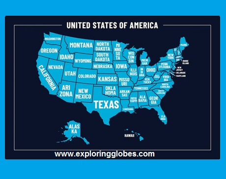
2. The continent of North America is home to 23 nations. The largest nation in North America is Canada, the second-largest nation in the globe and the northernmost nation on the continent. The largest economy in the world, the United States of America, is contained there.
3. Greenland, the largest island in the world, is situated on the continent of North America. Yet, the European nation of Denmark is the owner of Greenland. The northernmost location in the world is also associated with Greenland.
4. On the continent of North America, there are about 580 million people. The world’s largest concentration of Christians lives in North America. About 80% of the populace of Canada, the United States, and Mexico identify as Christians.
5. North America has five time zones and is the only continent with every type of climate.
6. It was named after the explorer Americo Vespucci and is also known as the “New World.”
7. Of the seven continents in the world, North America has the highest population density (22.9 people per square kilometer).
8. The largest freshwater lake in the world is Lake Superior in North America.
9. North America is home to the Mississippi River, the third-longest river in the world (3778 km), the continent with the greatest average per-person income among the continents, and the one with the highest average food intake.
10. North America includes the USA, which has the greatest economy in the world.
11. North America is the world’s top producer of soyabeans, maize, and other crops.
12. This continent is home to the Elf, the tiniest owl in the world.
13. The moose and the elk, found in North America, are the first and second tallest mammals on the continent.
14. Cuba, known as the “sugar bowl of the world,” is the world’s greatest exporter of sugar among the seven continents.
15. Hummingbirds, brown bears, bald eagles, bullfrogs, and brown bears are among the numerous notable animals found in North America.
Have a look at the list of North American nations and their capitals.
| SL.No. | North-America Country | Capital | Currency |
| 1 | Antigua and Barbuda | St. John’s | East Caribbean Dollar |
| 2 | Bahamas | Nassau | Bahamian Dollar |
| 3 | Barbados | Bridgetown | Barbadian Dollar |
| 4 | Belize | Belmopan | Belize Dollar |
| 5 | Canada | Ottawa | Canadian Dollar |
| 6 | Costa Rica | San Jose | Costa Rican Colon |
| 7 | Cuba | Havana | 2 currencies – Cuban Peso and Cuban convertible peso |
| 8 | Dominica | Roseau | East Caribbean Dollar |
| 9 | Dominican Republic | Santo Domingo | Dominican Peso |
| 10 | El Salvador | San Salvador | US Dollar |
| 11 | Grenada | St. George’s | East Caribbean Dollar |
| 12 | Guatemala | Guatemala City | Guatemala Quetzal |
| 13 | Haiti | Port-au-Prince | Gourde |
| 14 | Honduras | Tegucigalpa | Lempira |
| 15 | Jamaica | Kingston | Jamaican Dollar |
| 16 | Mexico | Mexico City | Mexican Peso |
| 17 | Nicaragua | Managua | Cordoba |
| 18 | Panama | Panama City | US Dollar (Panama locals call it Balboa) |
| 19 | Saint Kitts and Nevis | Basseterre | East Caribbean Dollar |
| 20 | Saint Lucia | Castries | East Caribbean Dollar |
| 21 | Saint Vincent and the Grenadines | Kingstown | East Caribbean Dollar |
| 22 | Trinidad and Tobago | Port of Spain | Trinidad and Tobago Dollar |
| 23 | United States | Washington, D.C. * | US Dollar |
El Salvador’s previous currency was the Colon, but in 2001 the US Dollar took its place.
Washington, D.C., is referred to as the “District of Columbia.”
The location of Washington is in this district. George Washington, a former US president, is honoured by the city’s name.
The District of Columbia is a federal district rather than a state (which means it is directly under the control of the federal government).
During the American Revolution, the word “Columbia” was used to refer to the US in a patriotic manner.
SOUTH AMERICA:
Details about the South Americas
1. The continent of South America is home to 12 separate nations.
2. With about 214 million people, Brazil is the largest and most populated nation in the continent.
3. This represents roughly half of the population of the continent.
4. Due to its size, Brazil has borders with nearly all of the other nations on the continent.
5. Sao Paolo, the largest city in the region with a metropolitan population of approximately 12 million, makes up five of South America’s ten largest cities, making Brazil even more populous than some South American countries.
6. South America is a continent of numerous natural marvels, including the Andes, the world’s longest mountain range.
7. The Atacama Desert in Chile and the Angel Falls, the highest waterfalls on earth. South America has 430 million inhabitants.
8. South America is home to the highest waterfalls in the world, the Angel Falls, as well as the second-longest river in terms of length (6440 km), the Amazon.
9. The green anaconda, the second-longest snake in the world, is found in South America.
10. This continent is home to the two tallest volcanoes in the world, Mt. Cotopaxi and Mt. Chimborazo.
11. Brazil, the world’s largest coffee producer, is located in South America.
12. The largest salt lake in the world, Salar de Uyuni (also known as the Uyuni salt flats), is located in South America.
13. Lake Titicaca, the highest lake in the world (3800 m), is also the largest lake in South America.
14. The Andes are the second-highest mountain range in the world, behind the Himalayas.
15. South American terrain contains these young-fold mountains.
16. The tallest peak in the Andes is Mount Aconcagua (7,021 m).
Have a look at the list of south American nations and their capitals.
| SL.No. | South-America-Country | Capital | Currency |
| 1 | Argentina | Buenos Aires | Argentine Peso |
| 2 | Bolivia | Sucre | Boliviano |
| 3 | Brazil | Brasilia | Real |
| 4 | Chile | Santiago | Chilean Peso |
| 5 | Colombia | Bogota | Colombian Peso |
| 6 | Ecuador | Quito | US Dollar |
| 7 | Guyana | Georgetown | Guyana Dollar |
| 8 | Paraguay | Asuncion | Guarani |
| 9 | Peru | Lima | Nuevo Sol |
| 10 | Suriname | Paramaribo | Suriname Dollar |
| 11 | Uruguay | Montevideo | Uruguay Peso |
| 12 | Venezuela | Caracas | Bolivar |
Other information about the Americas:
1 .Population The Americas are home to an estimated 998 million people, or 13% of the world’s population. Most populous Metropolitan Areas
2. The major cities in the Americas are: Los Angeles, New York, Buenos Aires, Mexico City, and So Paulo.
3. Highest Point At 6,960.8 metres, Argentina’s Aconcagua is the highest mountain in the Western Hemisphere (22,837 ft).
4. With a height of 6,168 metres, Denali in Alaska, commonly referred to as Mount McKinley, is the highest mountain in North America (20,239 ft).
5. Biggest Lake:-Lake Superior is the biggest lake in the Americas. It is the biggest Great Lake, and it is shared by the US and Canada. It is also the world’s largest freshwater lake, covering an area of 82,000 km2 (32,000 sq mi).
6. Lengthiest Rivers:-The Rio Amazonas (Amazon River), with a length of “at least” 6,400 km, is the longest river in the Americas (4,000 mi). The Peruvian portion of the Andes mountain range is where the Amazon River originates.
7. With a length of 4,880 km (3,030 mi), the Paraná is the second-longest river in the Americas. It passes through three nations—Argentina, Brazil, and Ocean.
8. Paraguay—before emptying into the Río de la Plata, an estuary in the Atlantic.
Given that the name of the “primary river” changes, there is a lot of debate regarding the longest river in North America.
9. At a length of 4,087 km (2,540 mi), the Missouri is the longest river in North America. Its source is in the Rocky Mountains in western Montana.
10. The Mississippi River, which rises in Lake Itasca in Minnesota, USA, is the second-longest river in North America at 3,766 km (2,340 mi).
America’s Principal Geographical Features
North America, South America, Central America, and the Caribbean are the major sub-regions.
Mountains
The American Cordillera, a network of mountain ranges spanning North and South America as well as West Antarctica, is made up of the Pacific Coast Ranges, the Rocky Mountains, and the Andes.
Plateaus and shields
North America –
North America’s Coteau des Prairies (in portions of South Dakota, Minnesota, and Iowa), Allegheny Plateau, Appalachian Highlands, Appalachian Plateau, Intermontane Plateaus with the Colorado Plateau and Columbia Plateau, Ozarks, and Yukon Plateau (Yukon Territory, Canada).
South America –
The Brazilian Highlands, the Mato Grosso Plateau, the Guiana Highlands, the Altiplano (High Plateau in Bolivia), the Atacama Plateau, the Guiana Shield, one of the three cratons of the South American Plate, and the Pakaraima Mountains, with Mount Roraima, are the major plateaus in South America (at the tripoint of Venezuela, Guyana and Brazil).
Lowlands –
There are a number of significant lowlands in the Americas, including the Great Plains (a portion of the Interior Plains of North America), which are found in the US and Canada, and the Atlantic coastal plain along the East Coast of the United States. The huge Amazon drainage basin, which takes up more than 35% of South America, is home to the lowlands of that continent. Uruguay, Argentina, and Brazil all share the fertile Pampas plains. Los Llanos (The Plains) is vast tropical grassland plain in Colombia and Venezuela, and the Gran Sabana (Big Savanna) is a sizable savanna region in Venezuela.
Deserts –
One of the driest regions on earth is the Atacama Desert, which is located in Chile and Peru. The largest and tallest salt desert in the world is located in Bolivia’s Salar de Uyuni (Salar de Tunupa). The Great Basin Desert is one of the largest deserts in North America, while the Patagonian Desert is the largest in the Americas. The Chihuahuan Desert covers a sizable portion of southern USA and northern Mexico. Much of the southwestern United States and the northwest Mexican states of Sonora, Baja California, and Baja California Sur are covered by the Sonoran Desert, which is the hottest desert in both Mexico and the United States.
Lakes –
Three of the Great Lakes of North America—Lake Superior, Lake Huron, and Lake Michigan—are among the largest freshwater lakes on the planet. Has an area of 8,372 km2. The biggest and safe lake in South America and world is Lake Titicaca.
Islands –
Greenland, Baffin Island, Victoria Island, Ellesmere Island, Newfoundland, Cuba, and Hispaniola are the largest islands in the Americas.
American languages –
When the Europeans arrived, the Americas were home to thousands of different languages. Spanish, English, Portuguese, some French and French-based creoles, and a few Amerindian languages are the main languages spoken in the Americas today.
Facts about Australia/Oceania :
1. The Latin word “australis,” which means “southern,” is where the name Australia originates.
2. Australia lies totally on the south of the equator and if frequently referred to the nation as “down under”.
3. The authority name of Australia is the Federation of Australia.
4. Australia is the world’s littlest landmass and is otherwise called an ‘island mainland’ as it is encircled by water on all sides.
5. The landmass of Australia is frequently called Sahul, Australinea or Meganesia to separate it from the nation of Australia.
6. The world’s biggest coral reef is the Incomparable Obstruction Reef is around 2000 kilometers in length.
7. Two-thirds of Australia is desert land.
8. Austria is home to north of 500 assortments of eucalyptus trees.
9. Of all the continents in the world, Australia stands at the top of wool production and import. This is because the sheep population in the world’s smallest continent is 14 times that of its human population.
10. The unique animals of Australia are kangaroo, emu and platypus.
11. Australia capital – Canberra-Sydney.

Credit – Freepik
Oceania
Oceania is a geographic district that incorporates Australasia, Polynesia, Micronesia and Melanesia.
Australasia
1. The area comprising of Australia, New Zealand, New Guinea, and adjoining islands in the Pacific Sea is in some cases alluded to as Australasia.
2. Australia, a nation and Earth’s littlest mainland.
3. Zealandia, a miniature mainland that incorporates the island nation of New Zealand.
4. The country New Zealand comprises of two principal islands: the North Island (Te Ika-a-Māui) and the South Island (Te Waipounamu).
5. Wellington-Auckland serves as the capital of New Zealand.
6. New Guinea, the second biggest island on earth (after Greenland).
7. The Pacific Islands, a large number of islands in the Pacific Sea separated into Melanesia, Micronesia, and Polynesia.
8. The most crowded nations in Oceania are Australia, with 25.9 million individuals; Papua New Guinea, with 9 million; and New Zealand, with 4.9 million occupants (in 2022).
9. The biggest urban communities in Oceania by populace are Sydney (pop. 5.2 million), Melbourne (pop. 4.9 million), Brisbane (pop. 2.5 million), Perth (pop. 2.1 million), and Auckland (pop. 1.4 million); aside from Auckland, all urban communities are situated in Australia.
Melanesia
1. East and south of New Guinea Island in the western Pacific Ocean lays an area known as Melanesia, whose northern border is the Equator.
2. The region contains New Guinea Island, the Bismarck Archipelago, Vanuatu, the Solomon Islands, Fiji, and Papua New Guinea, all of which are independent nations, as well as the French Dependency New Caledonia.
3. Melanesia contains many volcanically formed islands that are part of the Pacific Ring of Fire.
| Melanesia Countries | Capital |
| Fiji | Suva |
| New Caledonia | Noumea |
| Papua new guinea | Port Moresby |
| Solomon Islands | Honiara |
| Vanuatu | Port-Vila |
Micronesia
1. In the western Pacific Ocean, north of Melanesia and north and west of Polynesia, is an area known as Micronesia. The Equator essentially forms its southern boundary. 2. The Mariana Islands, the Federated States of Micronesia, Republic of Palau, the Marshall Islands, and the western Kiribati archipelago are all included in this region.
| Micronesia Countries | Capital |
| Guam | Hagatna(Agana) |
| Kiribati | Tarawa |
| Marshall Islands | Majuro |
| Micronesia | Palikir |
| Nauru | |
| Northern Mariana Island | Saipan |
| palau | Ngerulmud , Melekeok |
Polynesia
1. East of Micronesia and Melanesia, in the middle Pacific Ocean, lays a huge area known as Polynesia.
2.The region encompasses the easternmost Pacific island nations, such as Samoa, New Zealand, the Cook Islands, Hawaii, the Marquesas Islands (which are a part of French Polynesia), and the Cook Islands.
| Polynesia countries | Capital |
| American Samoa | Pago pago |
| Cook Island | Avarua |
| Easter Island (Chile) | Hanga Roa |
| French Polynesia(Tahiti) | Papeete |
| Hawaii | Honolulu |
| Niue | Alofi |
| Pitcairn | Adamstown |
| Samoa | Apia |
| Tonga | Nuku’alofa |
| Tuvalu | Funafuti |
Other facts about Australia
1. The highest peak in Oceania is Puncak Jaya or Carstensz Pyramid, which rises to a height of 4,884 m (16,024 ft) in the Papua Region of Indonesia on the island of New Guinea.
2. Oceania’s second-highest summit, Mauna Kea, is located on the island of Hawaii and rises 4,207.3 m.
3. The highest peak on Earth is Mauna Kea. It rises almost 10,210 meters from the ocean’s floor to its summit (33,500 ft).
4. With a height of 2,228 m, Mount Kosciuszko in New South Wales is the tallest mountain in Australia (7,310 ft).
5. The 3,500 km long Great Dividing Range, sometimes referred to as the Eastern Highlands, is a mountain range that runs along Australia’s east coast.
6. Mount Kosciuszko has the highest peak at 2,228 meters (7,310 ft).
7. The highest mountain in the Maoke Mountains, formerly known as the Snow Mountains, which are a part of the Central Cordillera of New Guinea.
8. Puncak Jaya, with a prominence of 4,884 m, is also the highest mountain peak of an island on Earth.
9. Supposedly, Lake Eyre (officially Kati Thanda-Lake Eyre) in South Australia, a seasonal lake with a surface area between 8,000 and 9500 km2, is the largest lake in Oceania/Australia.
10. Longest River: With 2,508 km, the Murray is Oceania’s longest river by a wide margin. [3] The river serves as a long-distance border between Victoria and New South Wales in Australia.
11. Deserts Arid and hostile terrain makes up about 35% of the Australian continent. The Outback, or central region of the country, gets so little rain that it is essentially a desert.
12. Australia has a number of designated deserts; the Great Victoria Desert in Western Australia and South Australia is the largest by area.
13. The Tanami Desert, the Great Sandy Desert, along with the Strzelecki Desert, the Simpson and Gibson Deserts.
14. Oceanic languages-Before the arrival of the Europeans, Oceania was home to a wide variety of languages. English, several French-based creoles, some Japanese, Aboriginal and Torres Strait Islander languages, Melanesian Pidgin, Hawaiian, Polynesian languages, Tahitian, and Maori are the main languages spoken in Oceania today.
15. Tourists riding camels: the well-known sunset camel ride at Cable Beach, Western Australia, 7 km (4 mi) west of Broome.

The World’s Oceans

All You Need to Know About Continents : Antarctica

All You Need to Know About Continent : THE AMERICAS

All You Need to Know About Continents : ASIA

All You Need to Know About Continents: Facts and More

All You Need to Know About Continents : AFRICA
-
 ASIA3 years ago
All You Need to Know About Continents : ASIA
-
 WORLD INFO3 years ago
All You Need to Know About Continents: Facts and More
-
 AFRICA3 years ago
All You Need to Know About Continents : AFRICA
-
 AUSTRALIA3 years ago
All You Need to Know About Continents : Australia
-
 AMERICAS3 years ago
All You Need to Know About Continent : THE AMERICAS
-

 EUROPE3 years ago
All You Need to Know About Continents : EUROPE
-
 ANTARCTICA3 years ago
All You Need to Know About Continents : Antarctica